Mt. Batolusong | Day Hike in Tanay, Rizal | DIY Travel Guide
kingtolentino.com is reader-supported. When you purchase through links on our site, I may earn an affiliate commission with no extra cost to you. This will help me run my website and channel to provide more content to everyone.
This is a blog different from the usual. If you've been following me for quite some time, you'll know that water is my element. I prefer to go to places with water activities. But this time, I tried to climb a mountain. Our destination is Mt. Batolusong in Tanay, Rizal. Located on the south end of the Sierra Madre Mountain range.
Why this mountain? 1) It is near Manila and 2) they say it is a perfect trail for beginners.
The trail has 4 Phases and 3 Summits. The trail in the first 3 phases is mostly covered by dense forest. While on the fourth phase, majority of the area has no shade.
I snapped this photo on the 3rd stopover going to Mt. Batolusong summit. While Wynne was resting on a makeshift bamboo seat, a bamboo backdrop and a little sunburst peeking.
At the 4th stopover, there’s a limestone rock protruding at the edge of the cliff. It was a little bit dodgy but we managed to climb on it for photos and videos.
The first summit is Duhatan Ridge, 442 MASL. It was named Duhatan Ridge because there were Duhat trees at this summit. After Duhatan Ridge, passed by a field of tall grass on both sides of the path.
As we continued our hike, the trail gets narrower and narrower until we reach the part where there's a steep drop on both sides. We barely made it to the 2nd summit.
Mapatag Plateau at 663 MASL, is known for the scenic view of a vast yellowish grass field. We arrived when the sun is at its peak in a place where there was no shade.
For some reason, we didn't felt the scorching heat because of the blustery wind. Stayed there for a while to regain our strength before our ascent to the final summit.
At the end of the Mapatag trail, slowly we entered a dense bamboo forest with a steep incline. Mustering our strength or what's left of it, we gave it our last push.
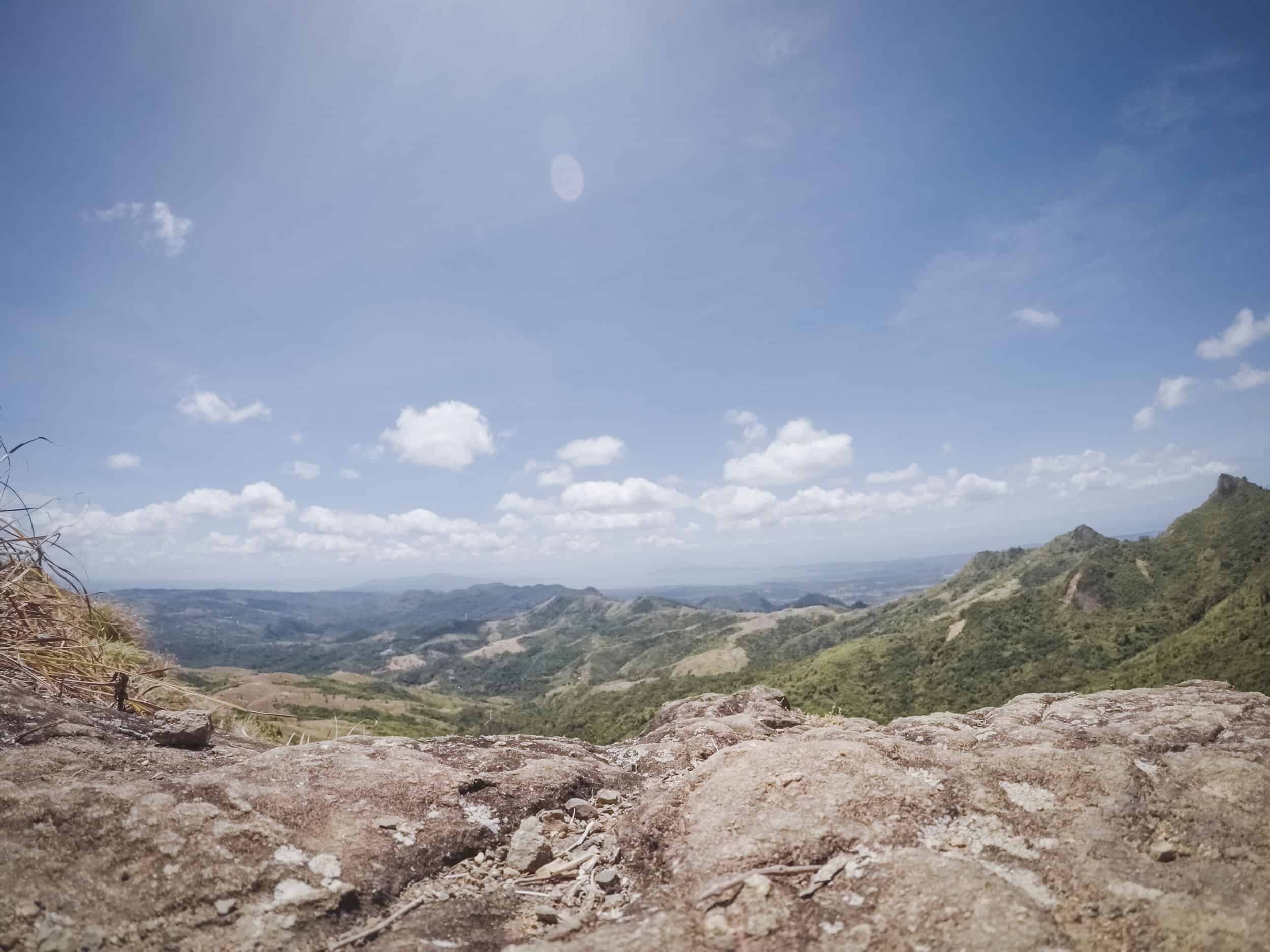
Finally, we reached Rangyas Peak - 883 MASL.
The panoramic view on top was definitely worth the trip.
Ending our first mountain hike experience by passing thru this rice field to the town of San Andres. PS. We took a dip in the cold waters of Sangab Cave before ending our trip. Too tired to take photos :D
WATCH THE FULL VLOG HERE
WHEN IS THE BEST TIME TO VISIT MT. BATOLUSONG
The best time to visit Mt. Batolusong is during dry season. This is from December to May. I recommend scheduling your trip around December to February to escape the summer heat.
WHAT ARE THE THINGS TO PACK TO MT. BATOLUSONG
Hiking outfit / Active wear
Hiking shoes / Rubber shoes
Protection from the sun
Extra clothes
Camera / Action Cam
Food / Snack / Drinks
Tumbler – Bring plenty of water.
Backpack
Back pack rain cover
Dry bag
Trash bag
HOW TO GET TO MT. BATOLUSONG FROM MANILA
The most convenient way to get to Mt. Batolusong from Manila is via car. From EDSA, exit to Ortigas Ave. Turn left to E. Rodriguez Ave. Follow the road up until you’ve reached Marcos or Marikina - Infanta Highway. Then turn right. Follow the road up Tanay - Infanta road. Turn left to Sta. Ines Road. Drive until you reach Barangay San Andres. Travel time is 3-4 hours.
MT. BATOLUSONG BUDGET AND ITINERARY
The estimated budget for a Mt. Batolusong Day tour if you are going alone via car is Php2,100.00. You can lower the following costs by going in groups: gas and tour guide fee. See expected costs below:
Registration Fee - Php 100.00/pax
Tour Guide Fee - Php 500.00/group of 5
Food / Snack / Drinks – Php500.00 estimate
Gas – Php1,000.00
NOTE: Rates indicated above may change.
IMPORTANT THINGS TO CONSIDER WHEN VISITING MT. BATOLUSONG
There are no restaurants near the area. Bring food and drinks.
Cash basis only.
Signal is weak in Barangay San Andres and in parts of the trail.
Parking is near the Registration Area.
The trail is around 2-3 hours to complete. But if you are a beginner and would like to take some photos, it is around 4-5 hours.
If you want to take a shower after, just ask in the registration area.
There are other trails you can climb in from San Andres.
MT. BATOLUSONG TRAVEL TIPS
Start the climb as early as possible (Around 4am) for the sea of clouds experience.
If you want to avoid the crowd, do not schedule on weekends and holidays.
The clearing will start after the fourth phase. That means that if you'll go there during summer,
expect a scorching hot day with no shade.Wear something light and comfortable. Also wear something that will protect you from the sun.
You can swim in Sangab Cave. Bring extra clothes.
There’s a source of drinking water in 3rd stop. You can refill your tumbler there.
If you will bring food and drinks, allocate some for your tour guide/s.
Do not leave trash behind.
WHAT’S IN MY BAG?
If you want to know more about the cameras, gadgets and travel essentials I use, check out “MY GEAR”


Must See Tourist Spots in Tanay, Rizal